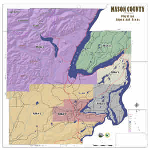
As the GIS consultant to Mason County, White Shield was responsible for the development of a GPS survey network and the development of a high accuracy parcel base map for the new County GIS database. White Shield worked directly with the County Public Works Department sharing responsibility of field data collection and office support, training of County personnel in GPS usage, assisted in GIS Database design, and the preparation of electronic documents required by the County. The PLSS grid was developed at approximately 1 mile spacing, using Static/RTK GPS methods and conventional traverse, and involved 500± PLSS corners in 350± sections. Research of timber company, local surveyor, and County/State survey records was also employed. Section breakdown was calculated to the 1/16 line
level, and GIS mapping was provided for the construction of 26,800± parcels using survey COGO techniques in 188 sections, as identified by the project owner
