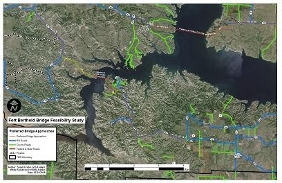
White Shield provided GIS Mapping for Little Missouri River and Lake Sakakawea Crossing, Fort Berthold Reservation, North Dakota, for the Three Affiliated Tribes – Mandan, Hidatsa, and Arikara Nation. As GIS Specialist, Mr. Fricke perform research for current and historical map files to support a bridge feasibility study for river crossings on the Little Missouri River, and Lake Sakakawea on the Fort Berthold Reservation for the Mandan, Hidatsa, and Arrikara Nation. Mr. Fricke is producing a variety of maps – ownerships, proposed bridge approaches and river crossings, contour maps, and aerial imagery – to support the engineers and planners.
